NAIP-CHM 0.6-meter Resolution Canopy Height Model for CONUS
Preprint Notice
This dataset is associated with a non-peer-reviewed preprint submitted to bioRxiv (December 12, 2025; updated April 29, 2026). The methodology and results have not yet undergone formal peer review. Users are encouraged to review the preprint directly and exercise appropriate caution when citing or applying this dataset in research.
Above-ground vertical structure is a critical variable for ecosystem monitoring, carbon accounting, wildfire modeling, and land management. To address the high cost and limited coverage of airborne lidar, the Numerical Terradynamic Simulation Group (NTSG) at the University of Montana developed NAIP-CHM — a 0.6-meter resolution canopy height and structure model (CHM) covering the contiguous United States (CONUS). Functionally acting as a normalized Digital Surface Model (nDSM), the dataset characterizes the full vertical structure of the landscape — including vegetation, buildings, and infrastructure — rather than masking human-made features as forestry-specific products do. This design makes NAIP-CHM uniquely suited for applications in the wildland-urban interface, rangeland management, and open-canopy ecosystems where existing products have historically struggled.
The model was built from NAIP 4-band aerial imagery (2012–2023, with 96% acquired in 2022–2023) using a U-Net convolutional neural network enhanced with Convolutional Block Attention Modules (CBAM) and Feature-wise Linear Modulation (FiLM) conditioning. Training used a peer-reviewed, publicly available dataset of over 22.8 million co-registered NAIP and lidar-derived CHM pairs stratified by EPA Level III ecoregion and NLCD land cover class — with grassland and shrubland classes intentionally oversampled to improve performance in open-canopy environments. The model achieved an overall pixel-wise RMSE of 2.28 m and r² of 0.87 on an independent test set of 2.27 million tiles. Read the preprint here.
Data Scaling
Pixel values are stored as scaled unsigned 16-bit integers (uint16) to optimize storage. Divide raw values by 100 to obtain canopy height in meters. The valid range is 0–120 m; nodata is encoded as 65535.
| Stored Value | True Height |
|---|---|
| 0 | 0.00 m |
| 100 | 1.00 m |
| 1500 | 15.00 m |
| 65535 | No data |
Dataset Coverage & Design
Spatial coverage: Contiguous United States (CONUS), excluding the Nevada Test and Training Range (southern Nevada) where NAIP imagery is restricted.
Spatial resolution: 0.6 m (nominal), matching the ground sampling distance of NAIP imagery. Each 432×432-pixel inference chip covers a 256×256 m physical footprint.
Imagery source: NAIP 4-band (R, G, B, NIR) orthoimagery acquired 2012–2023 (96% from 2022–2023). NAIP is collected during the growing season (leaf-on conditions) at a 1–3 year return interval per state.
Total dataset size: ~24.82 TB; 213,567 NAIP DOQQs processed covering approximately 7.7 million km².
Unlike many canopy height products that mask infrastructure to support carbon-only workflows, NAIP-CHM captures all elevated features — trees, shrubs, buildings, power lines, and other structures. Users requiring vegetation-only heights should apply an appropriate mask (e.g., NLCD land cover).
Citation
Morford, S. L., Allred, B. W., Coons, S. P., Marcozzi, A. A., McCord, S. E., Smith, J. T.,
& Naugle, D. E. (2026). A 0.6-meter resolution canopy height model for the contiguous
United States. Sci Data. https://doi.org/10.1038/s41597-026-07549-w
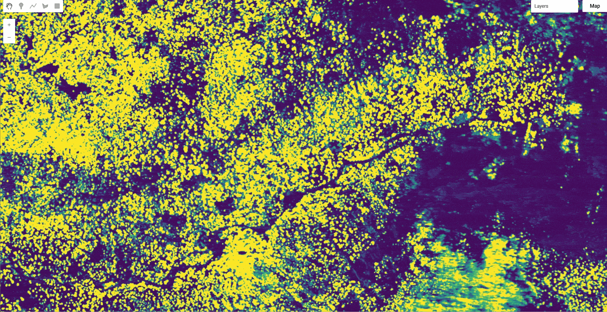
Earth Engine Snippet
var chm = ee.ImageCollection("projects/naip-chm/assets/conus-structure-model");
var naip = ee.ImageCollection("USDA/NAIP/DOQQ");

chm = chm.map(function(img) {
  var rescaled = img.divide(100)
  return img.select([]).addBands(rescaled).rename(['chm_meters'])
})

naip = naip.filterDate('2012','2024').sort('system:time_start',true)
Map.addLayer(naip,{}, 'naip source', false)

var viridis = [
  '#440154', // deep purple
  '#482777',
  '#3f4a8a',
  '#31688e',
  '#26828e',
  '#1f9e89',
  '#35b779',
  '#6ece58',
  '#fde725'  // bright yellow
];

Map.addLayer(chm.mosaic(), {min:0, max: 15, palette: viridis}, 'chm_meters',true)
Interactive Explorer: https://naip-chm.projects.earthengine.app/view/naip-chm-a-conus-structure-model
License & Usage
This dataset is licensed under Creative Commons Attribution 4.0 International (CC-BY 4.0). You are free to copy, redistribute, and build upon the material for any purpose, including commercially, provided you give appropriate credit, provide a link to the license, and indicate if changes were made.
Created by: Morford et al 2026
Curated in GEE by: Samapriya Roy
Keywords: Canopy Height, CHM, NAIP, CONUS, U-Net, Deep Learning, CBAM, FiLM, Lidar, Vegetation Structure, Wildfire, Rangeland, Open-Canopy, nDSM, Land Management
Last updated: 2026-06-02
 Ask AI